What did you learn? In this project, I learned a simple, effective way to make a map using Illustrator. The biggest thing I learned, though, was new uses for the pen tool, such as making roads. Originally the outliner had annoyed me, but with this project, I found it super useful, especially when making city roads.
What was easy? Other than choosing the location, the easiest part for me was definitely making the roads. I found it to be the most fun thing to do during the project. In my map, there was a rotary, so I got to practice making circles with the pen tool.
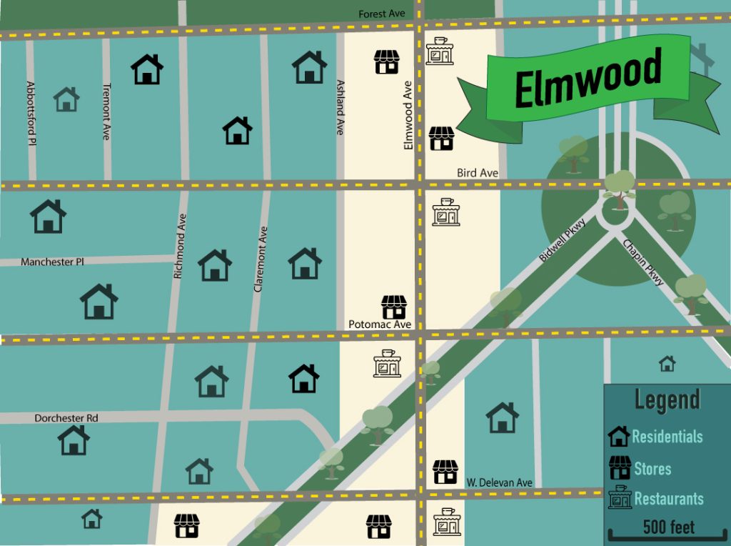
What was challenging? The most difficult part of the project was figuring out how I wanted to organize the roads. I settled on doing a sort of “popularity” scale. I made the more major roads (like Elmwood Avenue, Bird Avenue, W. Delevan Avenue, etc.) look like roads you would normally see, with broken yellow lines. I made the less popular roads just gray. I thought that this was the best way to convey important information, but figuring out how I wanted to organize stuff was definitely a challenge.
How could your submission be improved? I think my submission could be improved by adding a sort of “residential,” “commercial,” and “recreational” key somewhere. I used just colors (blue being residential, yellow being commercial, and green being recreational) and symbols to do this, but I’m not sure if that was enough.
How could the professor improve the assignment for the next class? The assignment could be improved by maybe providing some symbols somehow. I found some symbols I liked already in Illustrator, but finding a shop symbol was definitely difficult to do. Maybe that was something I struggled with, though.
How might you apply your knowledge in future assignments or work scenarios? Making maps for games could be something that this project would be useful for. Or, if a client were to ask for a decorated map of a place they’d previously been, I could easily replicate what I did here in this lab.
How did a specific reading or video inspire or help you? The presentation in D2L showing different kinds of maps gave me an idea on how to lay out mine. They also showed me that I didn’t necessarily have to do a city map, but could do one that conveys some other sort of information. Ultimately, I decided on Buffalo’s Elmwood/Forest areas, but the given maps inspired me to explore other options.