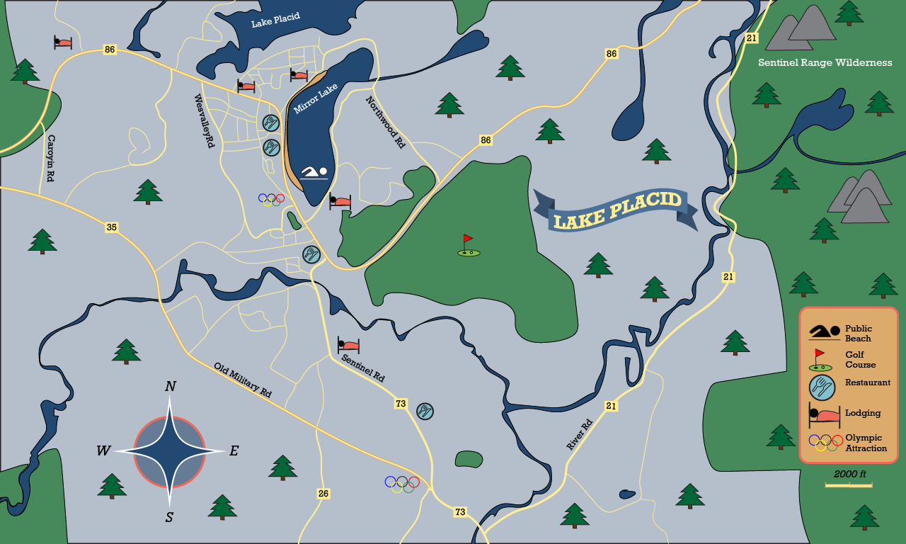

I chose to create the town of Lake Placid for Project 4. After the critique, I changed around a few items in order to make the map more readable. I changed the “Lake Placid” sign from blue to red to help it stand out more, made the Olympic symbol easier to view, added a few more icons, and made the text curved for the lakes and wilderness area.
This project was by far my favorite of the year and I learned a lot from it. I learned how to create a map from start-to-finish, including creating symbols, a compass, a flag, and other geographical aspects with the pencil tool. It was easy to draw the roads, rivers, and lakes. I honestly found it quite fun and would have gone into greater detail if I had the time. I also really enjoyed creating the symbols, I didn’t realize it would be so easy to accomplish. It was challenging to find a map area to create, as I struggled with which town and how zoomed out I wanted it to be. However, I ultimately chose Lake Placid as I really wanted to draw winding roads and aspects of nature. My submission could be improved if I made it more zoomed in and actually focused on the town, however, the region was much more exciting to do, so I wouldn’t change it. The professor could not change the assignment, every video was very helpful! The step-by-step instructions also greatly helped me through the project and made it quite easy to follow. I can apply this knowledge learned to future map-making projects and scenarios. I learned that I really enjoy this area of design so hopefully I get to do it again.